Dartmouth Park Healthy Neighbourhood – Interim Community Progress Report
Note: For the most up to date information visit dphnjointaction.com
Introduction
The London Boroughs of Camden and Islington launched, on 8 July 2024, a ‘co-design’ phase of a Low Traffic Neighbourhood (LTN) scheme. This ‘engagement’ (said not to be a ‘consultation’) is, unless the period is extended, for 6 weeks until 18 August. Representations have been made, so far without any success, by Highgate Society and other organisations and residents to extend that period until at least the end of September.
The proposal directly affects some 45 streets – thousands of residents with hundreds of vehicles – in an area with a rhomboid shape with the perimeter being Highgate Hill and High Street, Highgate West Hill and Highgate Road, Fortess Road and Junction Road. This is an unusually large LTN for which no precedent is known. It is by far the largest road scheme affecting the area for many decades.
It follows that very thorough and careful research is required before a scheme of this size can be introduced. The necessary research has not been done as far as we can see – This note lists the shortcomings and what needs to be done before any such scheme could be put into operation.
The statement of purpose of this Local Authority Plan is simply “This healthy neighbourhood aims to make the area greener, healthier and more pleasant to spend time in, making it easier to walk, wheel and cycle.” Such an entirely general statement omits any reference to the main effect of the scheme, which is to divert vehicular traffic. Any plans for the area must take traffic flows into account. There is nothing like enough information provided to know the effects of the scheme on traffic flows.
This note therefore does not contain any alternative proposals for what needs to be done to improve traffic flows in the area. What it does is to set out what needs to be done before any serious, properly researched and viable scheme can be introduced. That means a scheme with reasonably predictable effects. The current proposals make no attempt to predict the effects of the proposals on traffic flows, and that must be because those making the proposals do not have the necessary information. Local people want to be involved, and they too need the information to be able to engage as effectively as they should in discussions on the proposals.
Inadequacies in the proposals
- Origin and destination information
The proposals lack any reference to origin and destination information for journeys done in and through the area. If plans are made without knowing where the journeys that will be affected by them come from and go to then there is no way of knowing how the proposed changes will affect traffic flows.
For example, westbound traffic on Hornsey Lane that will not be able to use Dartmouth Park Hill may turn right up the Hill or left downhill. Highgate Hill and more so Highgate High Street are routinely congested during the day. Hornsey Lane has 3850 westbound vehicles a day, of which 1715 currently carry on down Dartmouth Park Hill. On the basis that almost none of those vehicles will have a destination in the upper-most part of Dartmouth Park Hill, which has hardly any residents, all those vehicles could be added to the Highgate Hill traffic. Whether they would, or could reasonably be expected to, use another route will depend on their origins and destinations. It will also depend more broadly on whether people choose another means of transport, not use that part of Hornsey Lane, or choose not to travel at all.
What about all the northbound traffic on Dartmouth Park Hill, 4344 daily in the central section of the road? Will they go up Highgate Hill, or Highgate West Hill, or take some other less obvious route?
Without origin and destination information about these very significant numbers of daily journeys, serious predictions of the effects of the Councils’ plans are simply impossible. The result would be little better than guesswork. And indeed it is significant that while the Councils’ plans show some proposed alternative routes which traffic might take, they do not in fact contain any information about predicted re-routing nor resulting congestion in such obvious places as Highgate Hill, Archway or Highgate West Hill.
Now obtaining origin and destination information requires a comparatively expensive survey. Camden and Islington may say it is unnecessary. But this is an exceptionally large LTN with impacts over a wide area. No costs have been provided but it must involve many hundreds of thousands of pounds of expenditure if fully implemented. We consider that it is not only reasonable expenditure but essential for such a survey to be conducted in this case, when the consequences of traffic re-routing will be so large.
- Consultation with Haringey
It seems that Haringey have not been involved in developing these plans. This is a serious omission for three principal reasons.
The first is that Highgate High Street and Highgate Hill above Dartmouth Park Hill are boundary roads, one side of which is Camden and one side Haringey. The changes proposed would directly affect Haringey residents and businesses on these roads and the surrounding areas of Haringey. No Council leafletting or other publicity has been done for the residents and businesses on the Haringey side of the affected area.
Secondly, Camden is proposing a new bus lane on a stretch of road – Highgate Hill – for which there is an agreement between the Boroughs that Haringey is responsible. Proper consultation with Haringey on this proposal is therefore essential.
Thirdly, some of the new recommended routes which are proposed as replacements for the closed routes run through Haringey residential roads, such as Cholmeley Park (2 routes) and Cromwell Avenue. In the absence of consultation with Haringey there is no information as to which of these routes might also become part of other Low Traffic Neighbourhoods, which has been suggested previously. Of course, if that were to happen these alternative routes would be unavailable.
It is worth commenting that when LTNs were described by Transport for London, when their introduction was first recommended, TfL provided a map of London showing where LTNs might be appropriate. None of the areas recommended for LTNs were anything like as large as this proposal area, and considerably smaller areas, including ones local to Highgate, were considered not suitable for LTNs because they were too large.
- Air quality
It is surprising that, as the title of the proposal is ‘Healthy Neighbourhood’, there is no mention at all of air quality in it. It has been claimed that some LTNs have improved air quality within them, while making the air quality worse in the peripheral roads to which the traffic is re-routed. Some evidence about this, or at least a survey of the evidence showing that there is no reliable evidence as to the effects of LTNs on air quality, should be included. Camden has, after all, been a leader in air quality monitoring. Where is the air quality worst and where does it most need improvement? How will this be measured?
- Congestion
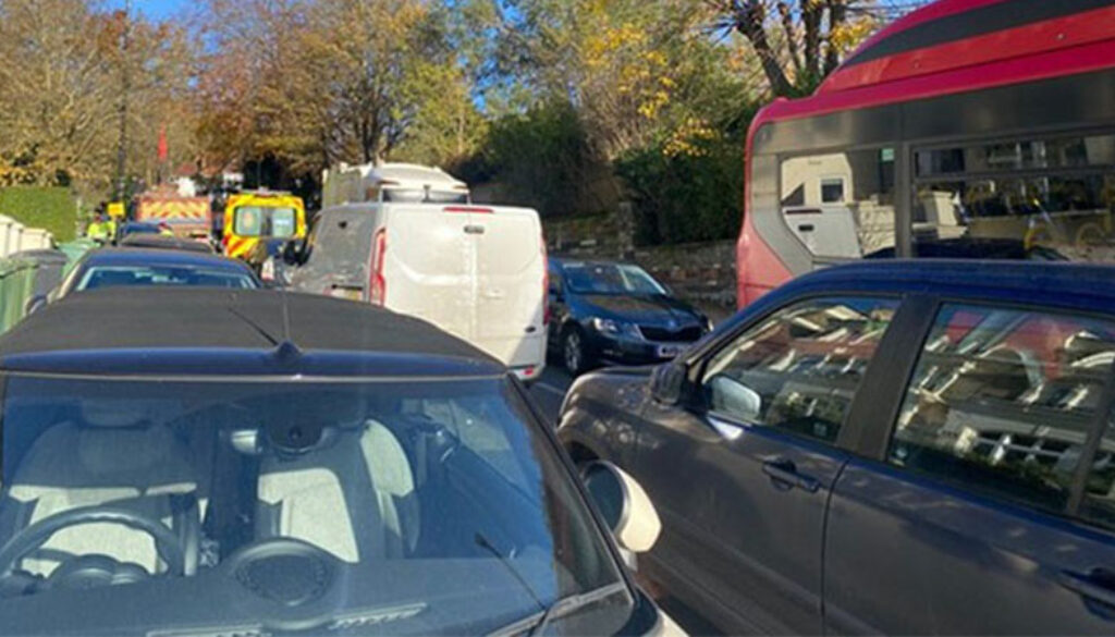
There is no reference in the proposals to what increased congestion would be likely because of the proposals. For example, the proposed route southbound down Archway Road to the Whittington Hospital is via Cromwell Avenue (a Haringey Road). Exiting from Cromwell Avenue at the junction with Hornsey Lane is awkward for any traffic, and often causes blockages. This is a very odd route to recommend. On a larger scale, it is impossible to judge how much more traffic will pass through the narrow Highgate Village roads, particularly the High Street and West Hill, on both of which streets congestion delays are common. This is partly because of the absence of origin and destination information, but also because there is a lack of traffic flow numbers in the proposal for that area. There are no numbers for the top of Highgate West Hill, and none for South Grove. South Grove could become a much more heavily used road for east- and westbound traffic, for which it is quite unsuited. In the absence of both these sorts of information it is only possible to hazard a guess at what the congestion effects might be.
Worse, if a scheme was introduced without this information there would be no baseline data against which any success or failure could be judged.
This is by no means a complete list of possible or likely congestion points, and the above are illustrations only. The subject is simply not addressed in the proposal.
- Lengths of journeys
No consideration is given to the effects on pollution and congestion, as well as the economic effects, of the longer journeys which would be necessitated by the proposal. There are many instances, and the following are merely examples: the distance from Highgate High Street to Chetwynd Road would be doubled, and from Highgate High Street to Chester Road would be more than doubled. Although Macdonald Road and Junction Road are adjacent, any route by car from the first to the second needs at least a mile, and much longer if a route was taken through Highgate Village.
Doubling the length of a journey is the same as introducing a second vehicle making that journey, and so has a significant effect on increasing congestion. This is something which could and should have been calculated so that these effects of the proposal can be seen, taking all the increases in journey distances into account. If the proposal is to go forward in anything like this form, it needs to be done now.
- Errors
In Figure 11 the route from Hornsey Lane (point 3) to Croftdown Road is omitted from the map. The route described in the text is in fact impossible with the road closures proposed.
While it may not be an error, it is notable that the only viable route both ways between Archway and Gordon House Road (and so to the Royal Free Hospital) is via Fortess Walk. This is a much-needed route and there is no reasonable alternative route on these proposals due to the complexity of reaching Chetwynd Road on a westbound journey from Archway (though one could possibly take a much longer route through Highgate Village). It is difficult to believe that it is seriously suggested that all the east- and westbound traffic needing to use this route will go down the one tiny road. The right-turning traffic from Fortess Road into Fortess Walk would inevitably cause considerable congestion, with similar problems as it emerged at the other end to turn right into Highgate Road.
Attention has previously been drawn to the fact that The Grove is excluded from the proposal area, although it is the obvious route for traffic to take from Highgate West Hill to Hampstead Lane, and therefore is likely to be substantially affected by the proposal which would increase traffic on Highgate West Hill. This error should be rectified.
- Trial Scheme and time-limited traffic orders
If something on this scale is to be introduced, it is essential that it be trialled. Indeed that would be consistent with Camden’s own policy. The current uncertainty could be rectified to some extent by the work proposed above being done, and the information provided, but only to a limited extent as it is by a trial that the actual effects are best assessed. In order for the effects to be effectively assessed it would be necessary for the scheme to be introduced in stages with the most serious problems being addressed first.
The issue here is that no particular problems are identified by Camden or Islington in their proposal documents. But clearly some of the safety measures (traffic calming on Highgate West Hill, pedestrian crossing points in various places) and the proposed bus lane could be introduced independently.
It is absolutely essential if such a proposal is to be introduced that the priorities are identified, and trial periods used so that the effects can be seen and measured. If it is to be introduced, then time-limited traffic orders should be made, so that a review would be required before any of the proposals could be made permanent.
- Benefits and measurement
There is nothing said in the proposal about how its effects will be measured nor about how its success or failure will be judged. This is perhaps the most serious gap in the proposal. Can it be seriously suggested that a scheme of this – or indeed of any – scale will be introduced without carefully defined outcome measures to determine to what extent it has achieved its objectives? Of course, for this to be done it will be necessary to define the objectives of the scheme more closely that the very general aspiration with which the proposal opens, and which has been quoted above.
It is suggested that once a serious attempt is made to identify what the scheme actually intends to achieve, linked to the measures which relate to each of its identified objectives, it may be that the shape of the scheme will change, and it will become something more modest which will have a much better prospect of achieving things that local people want.
- Public survey
For this purpose, a more structured public survey would also be useful: the current proposal omits any reference to particular problems raised by a public survey of local opinion. Of course, many people have a variety of opinions about their local street, but it should not just be those who shout loudest who are listened to.
This is described by the Boroughs as a ‘Co-design’ stage. The trouble with that is, with some notable exceptions, the residents and businesses are not traffic consultants, nor in the time available is there any question of them commissioning such consultants and getting a report, even if the funds for that were available. The consultation then becomes many localised responses from individuals and local groups, without any proper expert response to the design of the scheme as a whole. This cannot be an effective method of co-design.
4 August 2024


